Aerial Imaging Services in Bangor, ME
Bangor golden-hour aerial showing the Penobscot River flowing through the city with the Joshua Chamberlain Bridge, the downtown waterfront concert venue, the BGR airport runway visible to the west with KC-135 tankers on the ramp, and the rolling Maine forests stretching toward the horizon.
Bangor (Maine) is part of the Bangor Metropolitan Statistical Area (Bangor, Brewer, and surrounding Penobscot County communities — combined population approximately 155,000, the third-largest metro area in Maine after Portland and Lewiston, serving as the commercial and healthcare hub for northern, central, and eastern Maine) and has a population of approximately 32,700. Bangor is the third-largest city in Maine (population 32,700) and the commercial, healthcare, and transportation hub for northern and eastern Maine. The Northern Light Eastern Maine Medical Center expansion, I-95 and bridge infrastructure projects, the Year of Building housing initiative, and 101st Air Refueling Wing MILCON at BGR drive a stable $200+ million construction market. The BGR Class D airspace, KC-135 refueling tracks, Acadia National Park proximity, and Penobscot Indian Nation tribal lands create a multi-layered airspace environment requiring specialized local knowledge for compliant drone aerial imaging.
Serving Penobscot County & the Bangor Metropolitan Statistical Area (Bangor, Brewer, and surrounding Penobscot County communities — combined population approximately 155,000, the third-largest metro area in Maine after Portland and Lewiston, serving as the commercial and healthcare hub for northern, central, and eastern Maine) area
Request a Free Quote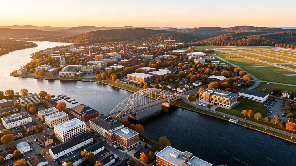
Get a Bangor Aerial Quote
Drone Services Serving Bangor, ME
Bangor is the third-largest city in Maine (population 32,700) and the commercial, healthcare, and transportation hub for northern and eastern Maine. The Northern Light Eastern Maine Medical Center expansion, I-95 and bridge infrastructure projects, the Year of Building housing initiative, and 101st Air Refueling Wing MILCON at BGR drive a stable $200+ million construction market. The BGR Class D airspace, KC-135 refueling tracks, Acadia National Park proximity, and Penobscot Indian Nation tribal lands create a multi-layered airspace environment requiring specialized local knowledge for compliant drone aerial imaging.
Drone Regulations & Airspace Rules for Bangor
FAA Part 107 Requirements
Flying for hire in Bangor? That is commercial operation under FAA Part 107, which requires a Remote Pilot Certificate — a credential we verify for every operator.
State Drone Laws
Commercial drone work in Bangor follows Maine UAS law (ME LD 812 / Public Law Chapter 463 (2015); 17 M.R.S. § 6554 (drone surveillance and harassment); 12 M.R.S. § 11266 (wildlife harassment); Maine Bureau of Parks and Lands state park drone permit rule; FAA Part 107; FAA LAANC), with city-level rules on top: Bangor is governed by Maine state drone law (LD 812 / Public Law Chapter 463, 17 M.R.S. Full Maine drone law →
Local Ordinances
Bangor is governed by Maine state drone law (LD 812 / Public Law Chapter 463, 17 M.R.S. Section 6554 surveillance harassment, 12 M.R.S. Section 11266 wildlife harassment) and FAA Part 107 regulations. The City of Bangor requires a permit for commercial drone takeoff and landing on city property, issued through the Bangor Parks and Recreation Department. Bangor city parks including Bangor City Forest, Cascade Park, and the Bangor Waterfront require explicit permission for commercial drone operations. The Bangor Waterfront concert venue and event space is managed by the Cross Insurance Center and requires authorization for commercial drone filming. Maine state parks require a special use permit from the Maine Bureau of Parks and Lands. Commercial drone filming for movies, TV, or advertising requires a film permit from the Maine Film Office. The Penobscot Indian Nation requires coordination for drone operations over tribal reservation lands. FAA Part 107 Remote Pilot Certification is required for all commercial operations. LAANC authorization is required for flights within BGR Class D airspace boundaries. Acadia National Park (50 NM southeast) requires an NPS special use permit for any commercial drone operations within park boundaries. Maine winter operations (November through March) require cold-weather battery management — LiPo batteries lose significant capacity at temperatures below 32 degrees Fahrenheit.
Restricted Airspace
- Bangor International Airport (KBGR) has Class D airspace with a 4 NM radius surface area covering the western portion of the city and the Penobscot River corridor. The airport is a joint civil-military facility hosting the 101st Air Refueling Wing of the Maine Air National Guard, which operates KC-135 Stratotanker aerial refueling aircraft. The KC-135s conduct heavy jet operations including low-altitude refueling training over northern and eastern Maine, creating significant jet traffic patterns. Commercial drone operations within the BGR Class D require LAANC authorization. BGR also serves as a transatlantic emergency diversion airport for flights crossing the North Atlantic, meaning wide-body jets can appear unexpectedly. The airport has a 11,439-foot main runway, one of the longest in New England.
- The 101st Air Refueling Wing at BGR operates KC-135 Stratotankers on active air refueling tracks over northern and eastern Maine. The refueling tracks extend across Penobscot County and into the vast uninhabited areas of northern Maine. While the tracks are at higher altitudes, the KC-135s conduct approach and departure operations from BGR that create low-altitude jet traffic along the Penobscot River valley. Drone operators should check NOTAMs for military flight activity, particularly during training deployments and when the wing hosts visiting aircraft from other bases. The Maine Air National Guard also supports homeland defense missions under Operation Noble Eagle.
- The Penobscot River corridor through Bangor has moderate commercial and recreational traffic including barge traffic, recreational boats, and occasional helicopter traffic. The Joshua Chamberlain Bridge and the Penobscot Narrows Bridge (approximately 20 NM south on Route 15) have infrastructure security considerations. Drone operators flying near the Penobscot River waterfront, the Bangor Waterfront concert venue, and the Maine Discovery Museum should maintain situational awareness of low-altitude helicopter traffic from news, medevac, and Maine State Police aviation units. The Eastern Maine Medical Center has active medevac helicopter operations from its rooftop helipad.
- Acadia National Park is located approximately 50 NM southeast of Bangor on Mount Desert Island. The National Park Service prohibits drone takeoff and landing within the park boundary without a research or commercial filming permit (36 CFR 1.5). While Acadia is outside the immediate Bangor area, it is a common destination for commercial drone operators based in Bangor. The park includes Cadillac Mountain (the first place to see sunrise in the US from October through March), Thunder Hole, and the Bass Harbor Head Light — all popular aerial photography subjects that require NPS permits for commercial operations. The park has no designated drone flying areas.
- Maine Bureau of Parks and Lands prohibits drone takeoff and landing in all state parks without a special use permit. Relevant state parks near Bangor include Bangor City Forest (multi-use trail system), Peaks-Kenny State Park (approximately 35 NM north on Sebec Lake), and Lily Bay State Park (approximately 60 NM north on Moosehead Lake). The Maine Department of Inland Fisheries and Wildlife restricts drone operations in wildlife management areas, particularly during nesting and breeding seasons (April through August). The Penobscot Indian Nation reservation lands along the Penobscot River have tribal sovereignty considerations — commercial drone operators should coordinate with the Penobscot Nation Department of Natural Resources for operations near tribal lands.
Airports in the area: BGR — Bangor International Airport (Class D airspace, located within the city limits approximately 3 NM west of downtown — civil-military joint-use airport with Maine Air National Guard KC-135 Stratotanker operations; LAANC available), BXM — Brunswick Executive Airport (Class D airspace, approximately 95 NM south — former NAS Brunswick, now civilian GA and corporate aviation; LAANC available; check for residual military restrictions), PWM — Portland International Jetport (Class C airspace, approximately 130 NM south — primary commercial airport for Maine; LAANC available but outside Bangor area), AUG — Augusta State Airport (uncontrolled GA airspace, approximately 75 NM south — state capital airport with no tower; check for nearby restricted areas), HUL — Houlton International Airport (uncontrolled GA airspace, approximately 110 NM north — small border airport; no tower, CTAF only)
Aerial Imaging Pricing Across Maine
Cost ranges are based on market data for Bangor Metropolitan Statistical Area (Bangor, Brewer, and surrounding Penobscot County communities — combined population approximately 155,000, the third-largest metro area in Maine after Portland and Lewiston, serving as the commercial and healthcare hub for northern, central, and eastern Maine). Actual pricing depends on site size, complexity, and deliverables.
| Service Type | Low End | High End |
|---|---|---|
| Topographic Data Collection | $900 | $3,300 |
| Drone Inspection | $300 | $1,350 |
| LiDAR Scanning | $1,625 | $4,950 |
| Environmental Monitoring | $425 | $1,900 |
| Aerial Imagery | $275 | $900 |
| Construction Monitoring | $300 | $1,250 |
| Real Estate Photography | $200 | $450 |
| Roof Inspection | $225 | $650 |
Free cost calculator, ROI calculator, and 14-page buyer's guide. No signup required.
Are you a drone operator serving Bangor? List your business on AeriusView and get pre-qualified leads in your service area.
List Your Business →How Bangor Builders Use Aerial Data
Bangor is the third-largest city in Maine (population 32,700) and the commercial, healthcare, and transportation hub for northern, central, and eastern Maine. The city has a modest but stable construction market driven by healthcare expansion, transportation infrastructure, housing, and military facility investment. Northern Light Eastern Maine Medical Center is the regional tertiary care hospital and is undergoing facility modernization including emergency department expansion, surgical suite upgrades, and a new cancer treatment center. The Maine Department of Transportation has active highway and bridge projects in the Bangor area, including I-95 corridor improvements, the Route 15/Route 9 connector, and the Penobscot River bridge rehabilitation program. The City of Bangor has designated 2024-2025 as the Year of Building with a focus on housing development — multiple residential projects are underway including the Kenduskeag Stream waterfront apartments, downtown upper-floor residential conversions, and affordable housing projects. The Bangor Housing Authority is investing in public housing modernization. The Bangor International Airport terminal is undergoing modernization with gate area upgrades and security screening expansion. The 101st Air Refueling Wing at BGR has ongoing MILCON projects including hangar maintenance, fuel system upgrades, and facility improvements. Bass Park Complex (including the Cross Insurance Center arena and convention center) has ongoing facility updates. Bangor is the primary retail hub for northern Maine with the Bangor Mall area seeing commercial tenant turnover and renovation. The University of Maine campus in nearby Orono (8 NM north) has ongoing research facility and student housing construction. Penobscot County building permit values exceeded $200 million in 2024.
Active Developers in the Area:
- Northern Light Health / Eastern Maine Medical Center (regional healthcare expansion — emergency department modernization, surgical suite upgrades, cancer treatment center, and outpatient facility construction across the Northern Light Health system)
- Maine Air National Guard / 101st Air Refueling Wing (MILCON projects at BGR including hangar maintenance, KC-135 fuel system upgrades, and facility modernization under federal National Guard construction appropriations)
- City of Bangor / Bangor Housing Authority (Year of Building initiative — residential development including Kenduskeag Stream waterfront apartments, downtown upper-floor conversions, affordable housing, and public housing modernization)
- Maine Department of Transportation (I-95 corridor improvements, Route 15 connector, and the Penobscot River bridge rehabilitation program across the Bangor area)
- University of Maine (Orono campus — 8 miles north of Bangor — with research facility construction, student housing expansion, and engineering building upgrades)
- Cross Insurance Center / Bass Park Complex (event venue modernization including arena upgrades, convention center renovation, and facility infrastructure improvements)

Why Hire Through Aerius View in Bangor, ME?
FAA-Certified
Every operator holds an active Part 107 Remote Pilot Certificate.
Local to Bangor
Based in the Bangor Metropolitan Statistical Area (Bangor, Brewer, and surrounding Penobscot County communities — combined population approximately 155,000, the third-largest metro area in Maine after Portland and Lewiston, serving as the commercial and healthcare hub for northern, central, and eastern Maine) and fluent in Maine drone law, with 2 nearby Bangor service communities in reach.
No Cost to Quote
Submit your project at no charge. Pay the operator directly if you proceed.
Fast Turnaround
Quotes in Bangor commonly move inside 2 business days once your request is in.
AeriusView is expanding in Bangor, ME
Bangor is an expansion market for the network, with demand driven by projects from Northern Light Health / Eastern Maine Medical Center and other local builders. Submit here and a verified operator covering Penobscot County is assigned.
Request a QuoteDrone Data Deliverables for Bangor Projects
These are the files you receive with a Bangor booking — all compatible with standard construction and engineering software. Projects like those delivered for Northern Light Health / Eastern Maine Medical Center across Penobscot County need data that drops straight into their workflow.
- Point clouds (LAS/LAZ) for 3D modeling and volumetric analysis
- DEM/DSM terrain models for cut/fill and grade analysis
- Contour lines (DXF/DWG, CAD-ready) for Civil 3D and Revit
- Progress reports with side-by-side comparisons for construction monitoring
- Orthomosaic maps (GeoTIFF) for site overview and documentation
- Coordinate systems matched to your project datum — the Maine State Plane zone, UTM, or a local datum your surveyor specifies
Insurance & Liability Protection
Pilot Insurance Required
Every operator matched to a Bangor project carries active liability insurance — minimum $1,000,000 general liability, verified from the certificate before the pilot joins the network. Bangor is governed by Maine state drone law (LD 812 / Public Law Chapter 463, 17 M.R.S. Section 6554 surveillance harassment, 12 M.R.S. Section 11266 wildlife harassment) and FAA Part 107 regulations. The City of Bangor requires a permit for commercial drone takeoff and landing on city property, issued through the Bangor Parks and Recreation Department. Bangor city parks including Bangor City Forest, Cascade Park, and the Bangor Waterfront require explicit permission for commercial drone operations. The Bangor Waterfront concert venue and event space is managed by the Cross Insurance Center and requires authorization for commercial drone filming. Maine state parks require a special use permit from the Maine Bureau of Parks and Lands. Commercial drone filming for movies, TV, or advertising requires a film permit from the Maine Film Office. The Penobscot Indian Nation requires coordination for drone operations over tribal reservation lands. FAA Part 107 Remote Pilot Certification is required for all commercial operations. LAANC authorization is required for flights within BGR Class D airspace boundaries. Acadia National Park (50 NM southeast) requires an NPS special use permit for any commercial drone operations within park boundaries. Maine winter operations (November through March) require cold-weather battery management — LiPo batteries lose significant capacity at temperatures below 32 degrees Fahrenheit.
FAA Part 107 Verified
Each pilot's Remote Pilot Certificate is checked against the FAA Airmen Inquiry before they can serve Penobscot County bookings. Expired certificates are flagged automatically.
Equipment Documentation
Pilots register their airframes and sensors (RGB, LiDAR, thermal, multispectral) so Bangor requests route to crews with the right payload for the job.
Site Safety Coordination
Pilots coordinate with your site superintendent for safe operations on active Bangor construction sites, including flight plans that avoid worker areas and equipment zones. Bangor is governed by Maine state drone law (LD 812 / Public Law Chapter 463, 17 M.R.S. Section 6554 surveillance harassment, 12 M.R.S. Section 11266 wildlife harassment) and FAA Part 107 regulations. The City of Bangor requires a permit for commercial drone takeoff and landing on city property, issued through the Bangor Parks and Recreation Department. Bangor city parks including Bangor City Forest, Cascade Park, and the Bangor Waterfront require explicit permission for commercial drone operations. The Bangor Waterfront concert venue and event space is managed by the Cross Insurance Center and requires authorization for commercial drone filming. Maine state parks require a special use permit from the Maine Bureau of Parks and Lands. Commercial drone filming for movies, TV, or advertising requires a film permit from the Maine Film Office. The Penobscot Indian Nation requires coordination for drone operations over tribal reservation lands. FAA Part 107 Remote Pilot Certification is required for all commercial operations. LAANC authorization is required for flights within BGR Class D airspace boundaries. Acadia National Park (50 NM southeast) requires an NPS special use permit for any commercial drone operations within park boundaries. Maine winter operations (November through March) require cold-weather battery management — LiPo batteries lose significant capacity at temperatures below 32 degrees Fahrenheit.
Drone Services FAQ for Bangor, ME
Do I need LAANC authorization to fly a drone in Bangor?
Bangor International Airport (BGR) has Class D airspace with a 4 NM radius covering the western portion of the city and the Penobscot River corridor. Commercial drone operations within the BGR Class D require LAANC authorization. BGR hosts the 101st Air Refueling Wing of the Maine Air National Guard, which operates KC-135 Stratotanker aerial refueling aircraft — the heavy jets create significant low-altitude traffic on approach and departure. BGR also serves as a transatlantic emergency diversion airport, meaning wide-body jets can appear unexpectedly. Check NOTAMs and use the FAA B4UFLY app before any flight.
What is the cost of aerial imaging for a construction site in Bangor?
Topographic drone data collection in Bangor typically ranges from $950 to $3,500 depending on acreage, terrain, and proximity to BGR Class D airspace. Construction monitoring visits cost $325 to $1,300 per session. LiDAR scanning runs $1,700 to $5,200. The Eastern Maine Medical Center expansion, I-95 corridor improvements, Bangor Year of Building housing projects, and University of Maine campus construction create steady demand for aerial mapping and progress documentation across the Penobscot Valley.
Can I fly a drone near Acadia National Park from Bangor?
Acadia National Park is approximately 50 miles southeast of Bangor on Mount Desert Island. The National Park Service prohibits drone takeoff and landing within park boundaries without a research or commercial filming permit (36 CFR 1.5). Popular aerial photography subjects including Cadillac Mountain, Thunder Hole, and Bass Harbor Head Light all require NPS permits. While the park has no designated drone flying areas, operators based in Bangor frequently travel to the Acadia region. Always coordinate with the NPS Acadia Permit Office for any commercial operations within park boundaries.
What are the considerations for drone operations near the Penobscot Indian Nation lands?
The Penobscot Indian Nation has reservation lands along the Penobscot River near Bangor. Tribal sovereignty means that commercial drone operations over tribal lands require coordination with the Penobscot Nation Department of Natural Resources. The tribal lands include islands in the Penobscot River and shoreline areas. Operators should respect tribal jurisdiction and obtain authorization before conducting commercial aerial imaging over reservation lands. The Maine Indian Tribal-State Commission can provide guidance on inter-jurisdictional operations.
What cold-weather considerations affect drone operations in Bangor?
Bangor has a humid continental climate with winter temperatures regularly dropping below 10 degrees Fahrenheit from December through February. LiPo drone batteries lose 40-60 percent of capacity at temperatures below freezing, and cold-weather pre-heating with battery warmers is essential. The best flying conditions are May through October, with fall foliage season (late September through October) providing peak aerial photography opportunities. Snow cover from November through April can affect ground-level terrain mapping accuracy. Always check NWS Caribou and NWS Gray forecasts before flying, as Maine weather can change rapidly.
What aerial imaging opportunities exist at the Bangor Year of Building housing initiative?
The City of Bangor has designated 2024-2025 as the Year of Building, focusing on housing development across the city. Multiple residential projects are underway including the Kenduskeag Stream waterfront apartments, downtown upper-floor residential conversions, and affordable housing projects. These projects require drone aerial imaging for site surveying, foundation inspection, structural documentation, and progress monitoring. The Bangor Housing Authority is also modernizing public housing units. Commercial operators should coordinate with the Bangor Planning Department and check for BGR Class D airspace boundaries near downtown and the waterfront.
Aerial Imaging Terms for Bangor Projects
First aerial project in Bangor? These terms cover the deliverables local pilots will quote you. Most Bangor projects in our cost table start around $200.
Orthomosaic
A geometrically corrected aerial photo map stitched from many images.
Point Cloud
A 3D dataset of points representing the captured surface.
Real-Time Kinematic
RTK GPS correction for centimeter-level positional accuracy.
LiDAR
Laser scanning that captures terrain through vegetation.
Digital Elevation Model
A 3D representation of terrain elevation across the site.
Ground Control Point
Known reference markers used to anchor and validate mapping accuracy.
Aerial Mapping
Data collection from above to map and measure a site.
Volumetrics
Cut/fill and stockpile volume calculations derived from terrain models.
Nearby Cities
Are You a Drone Operator in Bangor?
Penobscot County buyers search here — 6 active developers tracked in Bangor alone. Join the network and get matched leads. First lead free.
Ready to Start Your Project in Bangor, ME?
Tell us about your Bangor project and we route it to a vetted local pilot — free, no obligation. Projects in Penobscot County start around $200.
Request a Free QuoteAeriusView connects clients with FAA-certified drone operators. Services are not licensed land surveying. Deliverables are not authoritative for boundary determination, design, or legal purposes.